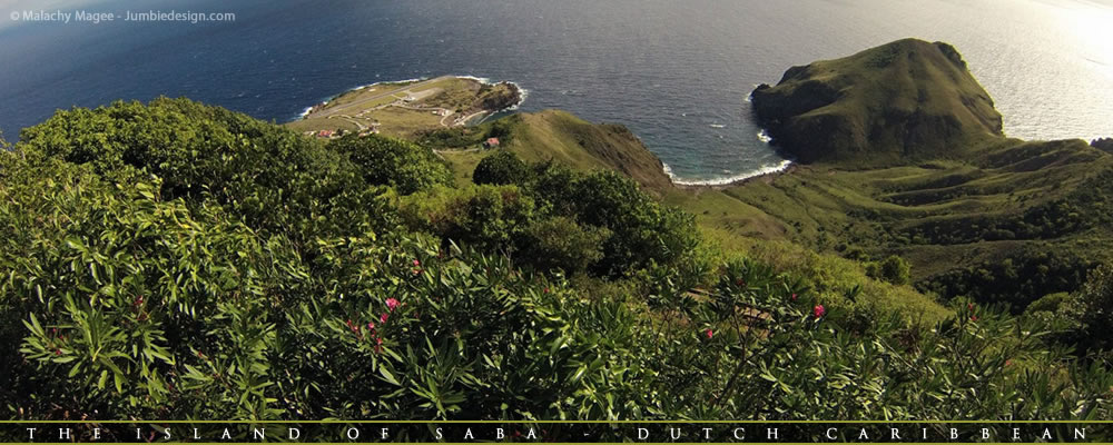
 |

| Activities Hiking: on Saba is a rewarding experience, nature above the waterline is as unique and varied as that which lies below... Let's take a walk down the slopes of Mt. Scenery and see what you can expect to find! The island’s vegetation varies with distinctive zones which are related to altitude and precipitation. The top of Mt. Scenery is more often than not enshrouded by clouds resulting in a cloud-forest environment. At slightly lower elevations rain-forest vegetation is present. Humidity decreases as one descends and the vegetation reflects the drier climate. Plants and trees found close to shore have adapted to the salty environment.  The Summit of Mt. Scenery Mt. Scenery is the highest point in the Dutch Kingdom (877m or 2877ft) and is Saba’s dominant feature. Dense vegetation with a variety of species cover the summit and upper slopes. The Elfin Forest (cloud-forest) dominates the upper 50m (150ft) of the mountain and is comprised of Mountain Mahogany covered with Epiphytes, Orchids and a myriad of other unique and rare plants. Lower slopes Just below the summit, Mountain Palms, Tree Ferns, Elephant Ears and Heliconias dominate. Secondary rainforest and dry evergreen forest are found lower down on the slopes. Species in this zone include Redwood, Sea Grape, White Cedar and Turpentine trees as well as Cacti species such as the Prickly pear. Closer to the sea, grassy meadows with scattered shrubs predominate. Steep cliffs and bluffs can be seen throughout the island with several sheer walls rising over 100m (330ft). Due to its rugged terrain, Saba does not have typical Caribbean beaches but there are several sandy bays that change with the prevailing ocean swells.  Flora and Fauna Flora and FaunaSaba’s plant and animal life is a mixture of native and introduced species. This occurred hundreds of years ago and it is very difficult for the average tourist to tell the difference today. Mango, banana, Black-Eyed Susan, tree frogs, goats and chickens were all brought to the island. Some of our endemic species are the Saban Anole lizards (found only on Saba), Green Iguanas and Red-Bellied Racer Snakes (completely harmless). Saba is home to over sixty species of birds, many of which are seabirds. Bridled Terns, Sooty Terns and Brown Booby birds breed every year in late spring on Green Island. Red Billed & White-Tailed Tropicbirds nest in the high cliffs while Frigate Birds and Brown Boobies soar near the coast. Other feathered visitors include the Common Ground Dove, Bridled Quail Dove, Red-tailed Hawks, Thrashers, Hummingbirds and Bananaquits.  One of the shorter hikes in Saba is the walk, partially climb, to the Tide Pools at Flatpoint. It's one of the few hikes that doesn’t take you through one of the different types of forest on the island, this area is at the coast of the island. One of the shorter hikes in Saba is the walk, partially climb, to the Tide Pools at Flatpoint. It's one of the few hikes that doesn’t take you through one of the different types of forest on the island, this area is at the coast of the island. The tide pools are small enclosures between cliffs and rocks which are filled with seawater and are the end product of an ancient lava flow. As the water is completely clear you get a spectacular view of the marine life including; different types of sea urchins, little colorful fish and sea flora. You also have dramatic views of the Caribbean Sea and the northeast side of the island. At certain times there is a rip current warning, due to the fact that the incoming waves can be very dangerous. Check with the trail shop as to the conditions!  Just down the road from the trail head of the tide pools you'll find Saba's only public swimming pool. Rocks have been placed in the cove as a barrier to the open ocean so Sabans (and visitors alike) can enjoy a refreshing swim in safety. Recently Sand has been added to the shore line effectively creating an artificial beach. If you don't feel like too much hiking this is the ideal spot to chill out for an afternoon, bask in the sun and enjoy the majesty of Saba as she towers above you. At the weekend it's not unlikely to find a barbeque in progress, an ideal time to get to know some of the islanders! Just down the road from the trail head of the tide pools you'll find Saba's only public swimming pool. Rocks have been placed in the cove as a barrier to the open ocean so Sabans (and visitors alike) can enjoy a refreshing swim in safety. Recently Sand has been added to the shore line effectively creating an artificial beach. If you don't feel like too much hiking this is the ideal spot to chill out for an afternoon, bask in the sun and enjoy the majesty of Saba as she towers above you. At the weekend it's not unlikely to find a barbeque in progress, an ideal time to get to know some of the islanders! Occasionally, depending on conditions, the usually rocky shores of Well's Bay are transformed into a stunning strip of golden sand, when our "disappearing- re-appearing beach is in, it's everything you can dream of if you are the Robinson Crusoe type: Nearly empty, no facilities, just pure tropical nature and an ideal snorkeling location.. Occasionally, depending on conditions, the usually rocky shores of Well's Bay are transformed into a stunning strip of golden sand, when our "disappearing- re-appearing beach is in, it's everything you can dream of if you are the Robinson Crusoe type: Nearly empty, no facilities, just pure tropical nature and an ideal snorkeling location.. Saba Villages Saba has four main villages, The Bottom (Saba's capital), Windwardside, St. John's & Zion's Hill (A.k.a. "Hell's Gate"). All are well kept and bristling with old Caribbean charm... Gingerbread houses with immaculate gardens and clean and safe streets await your exploration: easy to loose track of the day whilst meandering through...  The Bottom The BottomThe Bottom is Saba's capital and the seat of Saba's Government. Along with government and medical facilities you'll also find The Saba School of Medicine (Medical students and faculty make up almost a quarter of the islands entire population!). You'll also discover several small restaurants, bars and grocery stores. As you drive from the bottom to Well's bay, you'll see the old customs house that sits atop "The Ladder", the rugged steps that formed Saba's route to and from the sea long before the road was built. Climb up and down the steps once and you'll get a true appreciation of how tough life was for the Sabans, back in the day...  Windwardside WindwardsideOut of all the villages WIndwardside is the most tourist orientated. Drop by The Saba Tourist Bureau and say hello, you'll be within close proximity of six of the island's hotels and home to many vacation rental cottages You'll have no trouble passing a day wandering through small streets, investigating the museum & shops, a bite to eat is never far away... If you're up for some exercise pay a trip to the trail shop, pick up a map and a keepsake and then ascend the Mt. Scenery Trail to climb to the highest point in the Kingdom of the Netherlands! You can take a virtual tour of the village with this interactive map. Some businesses have changed but it's still fun to look around!  St. John's St. John'sSt John’s is one of Saba’s smaller villages. Before entering our Capital the Bottom you must drive through this quaint neighborhood. Here you can ask your Taxi to make stops to capture some of our best scenic shots on the island. On a very clear day you can see our neighboring islands St Eustatius, St Kitts, Nevis and, if you’re really lucky, even Montserrat! From this vantage point high above the Caribbean Sea, ships and boats can be seen coming and going to Fort Bay Harbor.. St. John’s played a big role in the island’s history, if a vessel was approaching someone from the village would signal to residents in the Bottom to let them know visitors would soon arrive. Be sure to check out Crispeen trail it will certainly take you back in time and give you a real feeling of the old St John’s.  Zion's Hill (A.k.a. Hell's Gate) Zion's Hill is the first town you'll reach after leaving the Juancho E. Yrausquin Airport. Hell's Gate was officially named "Zion's Hill" after complaints from the church forced the Island's government to change the name. However, "Hell's Gate" is still used by many Sabans and visiting tourists today. Hell's Gate is home to the Holy Rosary Church, a stone structure built in 1962, as well as a community center where visitors can purchase locally made Saba Lace, also called Spanish Work, and Saba Spice, a locally produced and very potent spiced rum. Hell's Gate is about 1000 feet above sea level. Lower Hell's Gate is home to a now-closed sulfur mine where visitors may explore with caution. Hell's Gate is also the start to the Crispin trail which one can take. The trail takes roughly 2 hours to complete and gives stunning views of Diamond Rock and the Saban coastline. Whilst enjoying the beauty of Saba's scenery here are a few things to keep in mind: Take only pictures... Leave only footprints! Have you told someone where you’re going and when you’ll be back? For your safety, stay on the trail and watch your footing All trails cross private land – please respect this privilege Don’t pick the fruit trees – they belong to someone Use the trash bins for all waste (pick up other garbage if you see it) Pick up after your dog and keep it under control at all times Be sure to carry sufficient water and use sun block Do not disturb plants or wildlife – it is against the law to do so! Have your Official Saba Nature Whistle available for a Trail Ranger upon request Report all violations of these rules to the Trail Shop (416-2630) Diving: Saba plunges below the sea as steeply as she rises above. From shallow patch reefs to deep underwater seamounts, Saba offers sites suitable for any diver’s level of experience. Past volcanic activity has created spectacular formations and structures. Underwater lava flows and hot springs are the most obvious evidence of Saba’s volcanic origins. The reefs are populated with schools of tropical fish and healthy coral. Sheer close-to-shore walls are covered with sponges of all sizes and the heavily encrusted deep-water seamounts attract pelagic creatures that are not normally seen by divers. Unusual and exciting sightings are always possible in Saba’s waters including frequent shark encounters. Saba offers year-round diving with seasonal differences in water temperature and surface conditions. The water temperature varies between 26C and 28C (77F-84F). Visibility ranges from a minimum of 20m (60ft) to virtually unlimited. Swells and heavy rainfall may influence visibility, but typically it clears again very quickly. Turtles and other critters If you’re lucky… Park Features Take only pictures... Leave only bubbles! |
 Fish
Fish Corals and Sponges